Ever wondered how drones are revolutionising the construction industry? “Surveying and Mapping: Drones in Construction Projects” is your gateway to understanding this technological marvel. In this insightful piece, you’ll discover how drones are not just flying gadgets but critical tools in transforming surveying and mapping tasks. With precision and efficiency, drones are reshaping how construction projects are planned and executed, saving time and resources. This subject is a vital application shift, making it a must-read for tech enthusiasts and industry professionals alike. Whether you’re passionate about drones or simply curious about their real-world impacts, this article will spark your interest and keep you informed on this exciting trend in the drone industry. Each paragraph here is designed to educate and engage, showing why drones are the future of construction projects.
How Do Drones Aid in Construction Surveying?
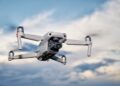
Drones have revolutionised the way we conduct surveying and mapping in construction projects. We’re talking about a massive leap in accuracy, efficiency, and cost-effectiveness. Previously, these tasks took ages and required a lot of manpower. Now, drones can do the job swiftly, capturing high-resolution images and creating precise maps, ultimately saving time and resources. It’s really a game-changer for the construction industry. Isn’t that fascinating?As for the drones used in surveying and mapping, they come equipped with advanced sensors, cameras, and GPS technology—essentially making them flying computers. These drones can hover over large areas, offering a bird’s-eye view, and gather detailed data that’s used to map the earth’s surface meticulously. They’re incredibly agile too, able to capture images from tricky angles. Quite impressive, right?
Safety regulations are an essential part of flying drones, ensuring that they operate safely without interfering with other air traffic or posing risks to humans. Rules might include restrictions on flight heights, no-fly zones like airports, and even certain hours when drones can’t be used. For drone operators, knowing and abiding by these regulations is crucial. After all, nobody wants to end up on the wrong side of the law.
Here’s a quick overview of how drones assist in surveying and mapping within construction projects: – Increased Efficiency: Drones gather data faster than traditional methods, speeding up project timelines. – Enhanced Accuracy: With high-resolution cameras and precise GPS technology, drones map sites with incredible detail. – Cost-Effective: Reducing the need for extensive manpower and equipment results in significant cost savings. – Safe Data Collection: Drones can access challenging or hazardous areas without putting workers at risk. – Real-Time Updates: Drones can provide consistent updates, offering a clear view of project progress.
Isn’t it remarkable how much drones have changed the landscape of construction projects? Their applications really seem limitless. What do you find most exciting about this technology?
Drones Revolutionising Surveying and Mapping in Construction
- Understanding Drone Navigation Systems
- GPS and Sensors: Most drones rely on GPS technology and a range of sensors to accurately navigate the skies. GPS allows drones to establish their position in real time, ensuring a steady course and the capability to return to their starting point effortlessly.
- Gyros and Accelerometers: Gyroscopes and accelerometers monitor the drone’s movement and orientation, helping it maintain equilibrium during flights—crucial for stability in windy conditions.
- Obstacle Detection and Avoidance: Many modern drones come equipped with cameras and sonar tools that help identify and circumvent obstacles. These features are incredibly important for safe flights, both outdoors and in confined spaces.
- System Integration: Advanced drone systems integrate data from these components to automate flight paths. Through dedicated software apps, users can pre-plan routes or manoeuvres, enhancing automation and efficiency.
- GPS and Sensors: Most drones rely on GPS technology and a range of sensors to accurately navigate the skies. GPS allows drones to establish their position in real time, ensuring a steady course and the capability to return to their starting point effortlessly.
- Features for Varied Users
- Beginner Modes: Many drones offer simplified controls or ‘beginner modes’ to assist new pilots in gaining confidence and mastering flight skills.
- Advanced Flight Capabilities: On the other hand, seasoned drone enthusiasts can take advantage of advanced flight capabilities like autonomous flight patterns, camera angling, or speed adjustments.
- Beginner Modes: Many drones offer simplified controls or ‘beginner modes’ to assist new pilots in gaining confidence and mastering flight skills.
- Applications in Various Industries
- Delivery and Logistics: Drones are pushing boundaries in delivery services, offering quicker and more efficient parcel disbursement, especially in hard-to-reach areas.
- Film and Photography: With high-definition camera integration, drones capture stunning aerial views, revolutionising the film and photography industries by providing unique perspectives.
- Surveying and Mapping: Drones equipped with mapping software and sensors are indispensable in surveying lands, assisting in urban planning, environmental conservation, and construction.
- Delivery and Logistics: Drones are pushing boundaries in delivery services, offering quicker and more efficient parcel disbursement, especially in hard-to-reach areas.
Real-World Uses of Drones in Construction
-
1. Topographical Surveys: Drones help create detailed 3D maps and models of construction sites, allowing for precise planning and execution. Elevation data helps avoid errors and aids in project design.
2. Cut and Fill Measurements: By calculating volumes of earth that need to be added or removed, drones streamline the initial site preparation stage. Engineers use this data to optimise resources and reduce costs.
3. Progress Monitoring: Regular aerial surveys track construction progress. These insights improve project management, ensuring timelines are met and stakeholders stay informed with visual updates.
4. Safety Inspections: Drones access hazardous areas without risking human safety. They inspect cranes, scaffolding, and other structures, identifying potential hazards or maintenance needs.
5. Infrastructure Assessment: Drones evaluate existing structures’ integrity, like bridges and tunnels, providing detailed visual data to guide maintenance and repair decisions. This boosts longevity and safety.
6. Boundary Mapping: For legal compliance and planning, drones offer precise boundary measurements. They ensure that construction respects property lines and regulatory standards.
Pros and Cons of Drones in Construction
Benefits- Faster data collection compared to traditional surveying methods.
- Enhanced accuracy and precision in mapping projects.
- Cost-effective solutions save on long-term expenses.
- Improved accessibility to hard-to-reach areas, reducing the need for human risk.
Cons or Drawbacks
- Limited flight time can restrict the survey scope.
- Initial costs for high-grade drones and software can be steep.
- Weather conditions like rain and wind can disrupt flights.
- Data accuracy may vary based on drone quality and conditions.
Future Trends in Drone Surveying and Mapping
In the near future, expect to see advancements in drone technology that enhance surveying accuracy, integrate AI for real-time mapping, and comply with evolving construction regulations, revolutionising how construction projects are managed.| Category | Before 2025 | After 2025 |
|---|---|---|
| Top Drone Models |
|
|
| Regulations |
Basic restrictions on night flying and privacy. |
Advanced regulations for urban flight and extended privacy laws. |
| Event Attendance Costs |
Average: £100 per person |
Projected: £120 per person |


